Wikisage, de vrije encyclopedie van de tweede generatie en digitaal erfgoed, wenst u prettige feestdagen en een gelukkig 2025
Wikisage is op 1 na de grootste internet-encyclopedie in het Nederlands. Iedereen kan de hier verzamelde kennis gratis gebruiken, zonder storende advertenties. De Koninklijke Bibliotheek van Nederland heeft Wikisage in 2018 aangemerkt als digitaal erfgoed.
- Wilt u meehelpen om Wikisage te laten groeien? Maak dan een account aan. U bent van harte welkom. Zie: Portaal:Gebruikers.
- Bent u blij met Wikisage, of wilt u juist meer? Dan stellen we een bescheiden donatie om de kosten te bestrijden zeer op prijs. Zie: Portaal:Donaties.
Categorie:Wikisage:Afbeelding:Geografie Europa
Naar navigatie springen
Naar zoeken springen
Ondercategorieën
Deze categorie bevat de volgende 8 subcategorieën, van de 8 in totaal.
E
Media in categorie "Wikisage:Afbeelding:Geografie Europa"
Deze categorie bevat de volgende 28 bestanden, van in totaal 28.
-
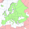
737px-Europe topography map.png 737 × 600; 526 kB
-
Bala Türkvizyon winner map.png 1.024 × 681; 163 kB
-
Belgica.png 787 × 799; 169 kB
-
Brabants.PNG 346 × 301; 15 kB
-
Denmark-Norway in 1658, Treaty of Roskilde.png 1.500 × 1.754; 65 kB
-
Domination Française.PNG 408 × 599; 504 kB
-
E20 route.png 500 × 524; 63 kB
-
Eastern Front 1941-06 to 1941-12.png 783 × 600; 312 kB
-
ECotY 2017 Map.png 1.000 × 794; 204 kB
-
ESC 2012 Map.png 1.000 × 794; 224 kB
-
EU location SWE.png 800 × 600; 388 kB
-
Europa RD-stelsel.png 563 × 548; 46 kB
-
Europe Extreme minimum temperature JAN 1 - 21 2017.png 2.400 × 2.500; 350 kB
-
Europe polar stereographic Caucasus Urals boundary.svg.png 1.000 × 779; 223 kB
-
European Fiscal Union.png 265 × 166; 5 kB
-
European union emu map en.png 1.165 × 1.200; 428 kB
-
European Union member states by form of government.png 560 × 599; 126 kB
-
Eurovision Dance Contest 2007 Map.png 967 × 768; 206 kB
-
Eurovision Dance Contest 2008 Map.png 967 × 768; 205 kB
-
Eurovision Young Dancers winners map.png 756 × 600; 153 kB
-
Eurovision Young Musicians winners map.png 1.000 × 794; 204 kB
-
France in the European Union.png 500 × 489; 80 kB
-
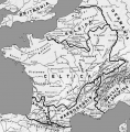
Map Gallia Tribes Towns.png 787 × 799; 352 kB
-
Mappa disoccupazione UE.png 560 × 599; 154 kB
-
Partage de l'Empire carolingien au Traité de Verdun en 843.jpg 1.113 × 1.024; 584 kB
-
Prostitution in Europe.png 720 × 600; 176 kB
-
Time zones of Europe.png 1.000 × 1.070; 245 kB
-
Unemployment European Union 2009-01.png 567 × 537; 109 kB


