Wikisage is op 1 na de grootste internet-encyclopedie in het Nederlands. Iedereen kan de hier verzamelde kennis gratis gebruiken, zonder storende advertenties. De Koninklijke Bibliotheek van Nederland heeft Wikisage in 2018 aangemerkt als digitaal erfgoed.
- Wilt u meehelpen om Wikisage te laten groeien? Maak dan een account aan. U bent van harte welkom. Zie: Portaal:Gebruikers.
- Bent u blij met Wikisage, of wilt u juist meer? Dan stellen we een bescheiden donatie om de kosten te bestrijden zeer op prijs. Zie: Portaal:Donaties.
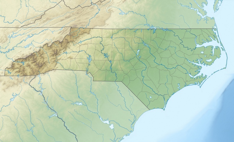
Bestand:USA North Carolina relief location map.jpg

Oorspronkelijk bestand (1.774 × 1.076 pixels, bestandsgrootte: 696 kB, MIME-type: image/jpeg)
English: Physical Location map of North Carolina, USA
Equirectangular projection, N/S stretching 120.0 %. Geographic limits of the map: N: 37.5° N S: 32.8° N W: 84.5° W E: 75.2° W
Date April 2010 Source Own work Data from http://naturalearthdata.com/, Scale: 1:50 Mio SRTM3, AVHRR Land Cover (http://www.landcover.org) ETOPO1 (http://www.ngdc.noaa.gov/mgg/global/global.html)
Author Alexrk2
Bestandsgeschiedenis
Klik op een datum/tijd om het bestand te zien zoals het destijds was.
| Datum/tijd | Miniatuur | Afmetingen | Gebruiker | Opmerking | |
|---|---|---|---|---|---|
| huidige versie | 1 mei 2017 11:53 |  | 1.774 × 1.076 (696 kB) | O (overleg | bijdragen) | https://commons.wikimedia.org/w/index.php?title=File:USA_North_Carolina_relief_location_map.jpg&oldid=204422458 English: Physical Location map of North Carolina, USA Equirectangular projection, N/S stretching 120.0 %. Geographic limits of the map: N... |
U kunt dit bestand niet overschrijven.
Bestandsgebruik
Dit bestand wordt op de volgende 2 pagina's gebruikt:
